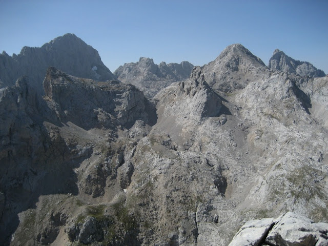
LA ROBLIZA FROM LAKE ERCINA.
Departing point: Lake Ercina 1.108 m
Loop: No
Time: 4 hours one way
The Route:
-----
La Robliza (2.227 m)
is located in the Cornion, the western part of the beautiful Picos de Europa
National Park.
We had read different opinions about the difficulty of the long ridge of loose rock that
leads to the top and decided it was time to go and see for ourselves.
The ascension from the
lake Ercina (1.108 metros) is a long day hike.
There are some parts of
the route where orientation is
really a problem if fog occurs. This may happen very
quickly and without warning.
You don't have to be a
mountain climber to reach the summit. However, a good portion of mountain experience
will be useful.
The route
From the parking lot, walk along the Lake Ercina towards the small stream coming from the North.
Follow the path upwards, close to the stream and enter the narrow valley that leads to " la Majada del Toyu" and then “la Vega el Paré”, the remaining of an ancient lake.
 |
| Majada del Toyu |
 |
| Vega el Paré from Majada Toyelly |
Turn
northwest (right) and upwards crossing the Majada el Toyellu (drinking
fountain) and follow northward through the long and chaotic” Camperas de
Jaces” and “Joos de Carbanal” until you reach the “Vega de la Aliseda
(1.800m)”.The route is mostly cairned and you'll be able to follow the path in
most places, easy to see in sunny days and with a very difficult orientation
with fog.

 |
| Picos de los Cabrones |
 |
| Vega de Aliseda y Verdelluenga |
Once in the Vega de la Aliseda, we can see a first range of mountains that hide our goal. From right to left we can see the group of "Torre de los Cabrones, LaVerdelluenga and more”.
We have to look to the East and try to find the pass“Collado de los Tiros” between those two mountains and look for the easiest way to get there. The route is partly cairned, and a vague path can be followed.
 |
| Verdelluenga and Collado los Tiros |
Collado
los Tiros (2.060 m)
From
the “Collado de los Tiros (2.060m)”, we first see La Robliza, with
the beautiful ridge between the “collado Llambredas” and the summit that
attracks us as like a magnet.
We can also see the huge depression known as “el
Joon”
The top of “La Verdelluenga - 2.129” only a few meters far to the East, so you may optionally climb it by a short scramble through the small gully that leads to the peak.

We
continue West, La Verdelluenga and Collado los tiros behind us,

looking for the best way to get to a small path that lead us to the Collado Lambredas (2.094m).

.jpg)
Once
in the Collado, a number of peaks appear:
Tiro de la Llera, Piedra
Lluenga, El Torco, Peña Santa.
Looking
east, we can see the whole ridge to the peak, It is more like a scramble but
losing the correct path you can end up in much steeper terrain.
We began the ascent of the ridge carefully, trying not to cause rockfall and keeping close to the ridge and always on the North face of the peak.
Just before the summit we have to stick to the ridge to top out on the ridge close to the summit cairn.
We may define it as easy climbing on loose rock. However, the last part has some points which some might consider exposed.

The
summit also offer superb views towards the mountains in the Cornion Massif, and
also the ones in the Central Massif or Urrieles.

Peña Blanca
El Tiro de la Llera, Torre del Alba
La canal Verde, los cabritos
Central Massif, and Torrecedo, (highest peak in Picos de Europa)

Down there, The Cares River.

Piedra Lluenga, Tiro de la llera, Torre del Alba , and behind them, Peña Santa, El Torco and Torre de Enol

El Cuvicente
The whole ridge
as seen from above, we downclimbed it carefully following the same route


Once in the Collado Llambreda, a last view to this beautiful peak.

Back to the car following the same route.

.JPG)


.JPG)


.jpg)


No comments:
Post a Comment