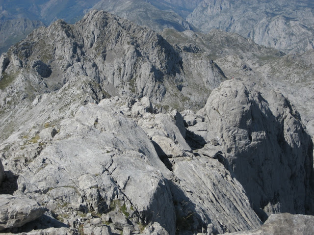
Requexon -2.174 m. (Ridge from Cotalba to Requexon )
Best hikes in Picos de Europa National Park.
 |
Western Massif of Picos de Europa as seen from Enol Lake |
NORMAL ROUTE to Requexon :
Pandecarmen (1.088m) – Vegarredonda Hut – Collado les Merines – East Ridge (Dif. I)
Departing Point: Pandecarmen (1.088m)
Return: 6 hours
Highest Point: 2.174 m
PROPOSED ROUTE WEST - EST RIDGE, From Cotalba to Requexón:
COTALBA TO REQUEXÓN RIDGE: Pandecarmen - Ordiales Viewpoint - Cotalba (2.026m), Torre de la Canal Vaquera (2.040 m), 3rd Poyon (2.089 m) and the Requexón (2.174 m) - Collado Merines - Vegarredonga Hut - Pandecarmen.

Departing Point: Pandecarmen (1.088m)
Return: 8 hours
Highest Point: 2.174 m
Difficulty of the Ridge:
- From Cotalba to Canal Vaquera: Easy (no clear paths, but easy)
- From Canal Vaquera to el Poyon (a short scramble dif. I)
- Requexon: West Face: A short scramble through a short but exposed gully (dif. III), Not easy to see from below. Half way of the gully there is a rappel point, you may continue over it or move a bit to the left.
- The descent follows the normal East route of Requexon (dif. I).
A very interesting activity consisting in climbing the whole line of mountains between the peaks Cotalba and Requexon, apart from visiting one of the highlights of the National Park: Ordiales Viewpoint.
The first part of the route follow the marked trail PR-PNPE 5: MIRADOR DE ORDIALES. (see this link).
Visit this link to access Ordiales Viewpoint route
To access the Cotalba, our first Peak we have to come back to the small house of the National Park Staff, and go to wide pass above us. Then follow de ridge, (some cairns) using sometimes your hands to gain easly the summit. (3,30 h)
From the Cotalba, we look for the best way to descent to Collada Sta. Maria, and then no problems to The Canal Vaquera Peak and the Horcada Vaquera.
 |
| Looking back from Torre Canal Vaquera |
 |
| Lake Ercinal |
from here we descent towards the Horcada Requexon and head towards the last difficulty.
 |
| Looking back at the Poyon |
The main difficulty of the whole route is in front of us, we began climbing without any clue, half way we see a rappel point. We can follow straight away or move a bit to our left. Anyway the way out is near.
The scramble is not difficult but it is very exposed.
 |
| The gully as seen from above |
The summit of Requexon.
Above us, the Poyones number 3, 2 and 1.
The view from the Peak. And some of the peaks I will describe soon.
We can see the descent route and the path we have to take.

The descent follows the normal ascension route (dif. I) until the collado les Merines, and towards the swithcbaking trail in the meadows that will takes us towards Vegarredonda Hut.
Near Vegarredonda hut
map of the route


No comments:
Post a Comment